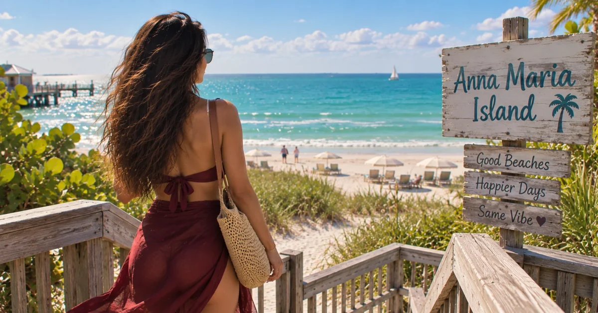
Anna Maria Island is the barrier island Tampa people bring up when they want the beach without the high-rise version of Florida. It is about seven miles of low buildings, three small towns, a free trolley, and a parking culture you will learn to respect very quickly. It is also farther from Tampa than most of the beaches we reach for on a Saturday, so it rewards a little planning.
This is the guide I would hand a friend flying into Tampa, or a neighbor who has lived here for years and somehow never made the drive. How far it is, which way to go, where to park, which beach fits your day, and the handful of things that decide whether the trip feels easy or turns into an afternoon of circling side streets.
Anna Maria Island is roughly 50 to 55 miles south of downtown Tampa, usually an hour to an hour and a quarter by car without heavy traffic. You can go down I-275 over the Sunshine Skyway or down I-75 along the east side of the bay. Both end up on Manatee Avenue (State Road 64), which carries you over the bridge into Holmes Beach. Weekend mornings and bridge traffic move that estimate more than your choice of route does.
How Far Is Anna Maria Island From Tampa
Look it up in three places and you will get three answers, anywhere from the mid 40s to around 60 miles. None of them are wrong. Tampa is spread out, and the island is seven miles long, so the number depends on whether you start downtown, in Westshore, in Brandon, or at the airport, and whether you are heading to Holmes Beach in the middle or Bean Point at the northern tip.
For a typical downtown start to the middle of the island, plan on 50 to 55 miles. On a clear weekday morning that is a little over an hour. On a sunny Saturday in March, with everyone else pointed at the same bridge, it can run closer to an hour and a half. I treat it as a full day trip, not a quick afternoon, and I leave earlier than feels necessary.
The Two Main Routes From Tampa
There are really only two sensible ways down, and people who live here have strong opinions about both.
I-275 over the Sunshine Skyway
This route runs south through St. Petersburg and over the Sunshine Skyway Bridge, about four miles of bridge across the mouth of Tampa Bay, then drops you into Manatee County. From there you work your way into Bradenton and turn west on Manatee Avenue toward the island.
If you have never crossed the Skyway, take this route at least once. The view from the top is the best free show in Tampa Bay, and it makes the drive feel like the start of the trip rather than a chore. The trade-off is that you have to get through St. Pete traffic first, and the Skyway is the one toll on the whole drive. If you are in a rental car, check how the company handles tolls before you leave the lot, so a small charge does not turn into a surprise fee later.
I-75 down the east side of the bay
This is the no-toll, no-scenery option, and it is what a lot of people on the east side of Tampa use without a second thought. If you are starting from Brandon, Riverview, or anywhere near the interstate, it is usually the simpler drive. Head south on I-75 and exit onto State Road 64, then follow Manatee Avenue west all the way to the water.
Here is the part the map apps do not really prepare you for. Both routes finish on Manatee Avenue West, a long, stoplight-heavy road through west Bradenton, and that final stretch is where a lot of your time actually goes. The interstate part is fast. The last several miles are not. Build that into your expectations and the drive feels a lot less frustrating.
The Three Bridge Connections Around Anna Maria Island
Two bridges connect Anna Maria Island directly to the mainland, one on Manatee Avenue and one on Cortez Road. A third bridge at the southern tip links the island to Longboat Key. Knowing which one you are using changes your day.
Manatee Avenue (State Road 64) into Holmes Beach
This is the main entry for anyone coming from Tampa. The bridge crosses from Perico Island and lands you in Holmes Beach, in the middle of the island, right about where Manatee Avenue meets Gulf Drive. Manatee Public Beach sits almost at the end of the road, which makes it the obvious first stop if you just want to get your feet in the sand. Road and utility work can occasionally affect this approach, so check current traffic conditions before leaving Tampa.
Cortez Road (State Road 684) into Bradenton Beach
The second entry crosses from the old fishing village of Cortez into Bradenton Beach at Bridge Street. The current Cortez Bridge is a drawbridge from 1956, and when it opens for a passing boat, traffic in both directions simply stops. That is part of its old Florida character, and also the reason it can quietly cancel out any time you thought you were saving.
Replacement construction is now underway on a taller fixed bridge. The old drawbridge is expected to stay open for most of the project, but traffic shifts are planned, the first around the end of 2026 and another around mid 2028. For the next couple of years, treat this approach as a construction zone and give yourself a little extra time.
Longboat Pass from Longboat Key
This bridge links the southern tip of the island to Longboat Key rather than to the mainland. It matters if you are coming up from Sarasota, or if you want to make a loop of the coast, but it is not how most Tampa drivers arrive.
Parking: The Part Nobody Warns You About
If there is one thing that trips up first-time visitors, it is parking. Anna Maria is a small island with a lot of residential streets and a lot of visitors, and the towns enforce the rules strictly. Tickets come quickly.
The rules are simple once you know them. Park in the direction of traffic. Keep all four tires off the pavement where signs require it. Do not block driveways, sidewalks, or anyone’s lawn. And read every sign, because plenty of streets near the beach are no parking at all, no matter how empty they look.
The bigger public lots at Manatee Public Beach and Coquina Beach are free and have restrooms, which is exactly why they fill first. On a weekend or holiday, arriving before about ten in the morning makes a real difference. After late morning, you can spend a long time looking. The simplest approach is to use one of the large public beach lots, arrive early, and read the signs carefully anywhere you park on a street.
The Free Island Trolley
The trolley is the single most useful thing to know about Anna Maria Island, and a surprising number of day-trippers never use it. It runs up and down the island along Gulf Drive, from Coquina Beach at the southern end to the City Pier area at the northern end, and it is free.
Service runs from early morning, around six, until about half past ten at night. Trolleys come about every 20 minutes throughout the day, seven days a week, though traffic and weather can push that around. Stops are every few blocks, many with covered seating, and the trolleys are air-conditioned, which you will appreciate in July. There is a bike rack on the front that holds two bikes, and small dogs can ride in carriers.
If you want to confirm the current schedule, Manatee County posts it on its transit page. Otherwise, the move is simple. Park at Coquina or Manatee Public Beach, ride north to Pine Avenue for lunch and a walk, and ride back when you are done. No circling, no tickets.
The Island, Town by Town
Anna Maria Island is actually three separate towns, and each end has a different feel. Knowing which one fits your day saves you from driving the length of the island looking for the right spot.
Anna Maria (the north end)
The quietest and most residential of the three. Pine Avenue is the heart of it, a short, walkable street of small shops, restaurants, and older island buildings, with a small historical museum nearby. At the end of Pine Avenue is the Anna Maria City Pier, which has stood in some form since 1911. It lost its walkway in the 2024 hurricanes and is being rebuilt, with the city currently targeting late fall 2026, subject to construction delays. Until you see it open, assume you cannot walk it.
Past the neighborhoods at the very northern tip is Bean Point, the least developed beach on the island. There is no parking lot, no restrooms, and no signs pointing the way, which is exactly why it feels so removed. The main access is a small path near North Bay Boulevard and North Shore Drive, and parking is limited street parking only, strictly enforced. Get there early or walk in from Pine Avenue.
On the bay side nearby, Bayfront Park is the calmer alternative. It has restrooms, outdoor showers, covered picnic pavilions, and a view back across the water toward the Sunshine Skyway. It gets noticeably fewer tourists than the Gulf beaches, and it is a popular spot to launch a kayak or paddleboard. If you do, respect the boat traffic and the currents, and check the wind before you head out.
Holmes Beach (the middle)
This is where most people from Tampa land, simply because Manatee Avenue drops you here. Manatee Public Beach is the easy default: free parking, restrooms, outdoor showers, changing areas, a concession stand, and a trolley stop right there. It is also the busiest beach on the island for the same reasons. If you want everything in one place with no planning, this is it. If you want quiet, keep going.
Holmes Beach is also the practical center of the island, with the shopping area along Marina Drive for groceries, supplies, and a few sit-down restaurants.
Bradenton Beach (the south end)
Bradenton Beach has the most walkable little strip on the island. Bridge Street runs from Gulf Drive to the bay and ends at the Historic Bridge Street Pier, which is open daily and unaffected by the rebuild up north. It is where you go to watch pelicans, fishermen, and boats, and it is my pick for a pier view right now while the City Pier is closed.
At the southern end of town, Coquina Beach is the family beach. The picnic areas are shaded by pine trees, there is room to spread out, and it is the southern end of the trolley line. In the cooler months, a seasonal market sets up there on select days, which is worth checking if your visit lines up.
Which Beach Should You Pick?
If you only have one day, do not try to see all of them. Pick the one that matches what you actually want.
Families with young kids: Coquina Beach or Manatee Public Beach. Both have restrooms, showers, and parking, which matters more than anything else when you are hauling a cooler and a toddler.
A quiet walk or sunset: Bean Point, keeping in mind the dangerous currents, the lack of lifeguards, and the lack of facilities.
Fewer crowds with restrooms: Bayfront Park on the bay side.
Beach plus walking to lunch: the Bridge Street area in Bradenton Beach, or Pine Avenue in Anna Maria, both an easy trolley ride from the big lots.
Where to Eat on and Near the Island
You won’t find the usual chain restaurants on Anna Maria Island, and that is part of what keeps the dining scene feeling local. The flip side is that eating here leans toward sit-down restaurants, and dinner at the popular spots fills up fast. For anything near sunset, book ahead or eat early.
The Porch
The pick for a proper dinner on the north end. The grouper and the ribeye are the dishes people keep going back for, and the porch seating is pleasant on a mild evening. It fills early, so either reserve or show up close to opening for dinner.
The Waterfront Restaurant
Across the street from the bay near the City Pier, with covered outdoor seating and a menu built around local fish. The calamari is the thing to order. Check the current hours before you go, especially around seasonal maintenance periods.
The Chateau Anna Maria
The dressier option in Holmes Beach, better for an anniversary or a celebration than a sandy post-beach meal. Check the current hours before you go.
Beach House Waterfront Restaurant
Right on the sand, with a big patio facing the Gulf. It is the easiest way to get dinner and a sunset in one place. If you want an outdoor table around sunset, arrive early and expect a wait. Complimentary valet helps with the parking problem.
Cortez: The Stop Right Before the Bridge
If you come or go by Cortez Road, stop in Cortez. It is one of the last working fishing villages on this stretch of the Gulf coast, with commercial boats still unloading at the docks and old fishing family cottages still lived in. It takes about five minutes to reach from Bradenton Beach, and it feels like a different decade.
Star Fish Company, at 12306 46th Ave W, is the reason most people make the stop. It is a seafood market with a dockside restaurant where you order at the counter and eat at picnic tables over the water. It is casual, and in the busy winter season the line can take a long while, so it is not the place for a quick bite or table service. Hours vary by day, and it has been reported as cash only, so check before you go. Tide Tables nearby is another waterfront option. Every February, the village hosts the Cortez Commercial Fishing Festival, the best time to see the community in full swing.
When to Go
The island is busiest in late winter and spring, when seasonal residents are in town and spring break adds to the crowd, and on holiday weekends year round. That is when parking and bridge traffic are at their worst. Summer brings heat and afternoon thunderstorms, but midweek summer days can be surprisingly calm. Fall weekdays are, in my experience, the easiest time to make the drive.
Hurricane season runs from June through November. The island has recovered well from the 2024 storms, and nearly everything is open, but conditions can change quickly after a major storm. It is worth checking local updates before you go during that stretch.
How I Would Plan a Day From Tampa
Leave Tampa by eight on a weekend, a little later on a weekday. Take the Skyway if it is your first trip, I-75 if you are coming from the east side. Head straight down Manatee Avenue to Manatee Public Beach and park before the lot fills.
Spend the morning on the beach, then take the trolley north to Pine Avenue for lunch and a walk, and out to Bean Point if you want the quiet end of the island. Ride back mid afternoon. Before sunset, move to the Bridge Street area for the pier and an early dinner on the water.
Then pick your exit on purpose. Either leave before about four, ahead of the late-day backup, or stay through dinner and leave after dark, when the sunset crowd has cleared. Leaving right at sunset, with everyone else, is the slowest drive home you can choose.
If the Drive Feels Too Long
An hour or more each way is a real commitment, and Anna Maria sits too far south to pair easily with the beach towns north of Tampa in the same day. If you want the Gulf with a shorter drive, the north side of the bay is the easier call. Our guide to driving from Tampa to Dunedin covers a closer option with its own island beaches and a walkable brewery downtown.
And if you end up on that side of the bay with time to spare, Dunedin pairs well with a Greek lunch a little farther up the coast. Our local guide to Tarpon Springs covers the drive and where to eat.
Frequently Asked Questions
Plan on an hour to an hour and a quarter from downtown Tampa without heavy traffic, covering roughly 50 to 55 miles. On busy weekends it can stretch toward an hour and a half, mostly because of bridge traffic and the long, stoplight-heavy drive down Manatee Avenue in Bradenton.
Only if you take I-275 over the Sunshine Skyway Bridge, which is the one toll on that route. Taking I-75 down the east side of the bay avoids tolls entirely. If you are in a rental car, check how the company handles tolls before you leave.
From Tampa, it is not practical. Public transit requires several connections and takes far longer than driving. If you are flying in and do not want to drive much, Sarasota Bradenton International Airport is much closer to the island than Tampa International. Once you are on the island, the free trolley makes a car largely unnecessary.
Bean Point has strong and potentially dangerous currents where the Gulf and Tampa Bay meet. The city has posted warning signs advising visitors to swim at their own risk, and there are no lifeguards. I would treat it as a place for walking, shelling, and sunsets rather than swimming. For swimming, Manatee Public Beach, Coquina Beach, and Cortez Beach are better choices, since Manatee County provides lifeguard services there.
Fall weekdays are the easiest, with lighter crowds and manageable traffic. Late winter, spring break, and holiday weekends are the busiest times, when parking fills early and the bridges back up. Summer is hot with afternoon storms, but quieter midweek.
As of this writing, the historic City Pier is still being rebuilt after losing its walkway in the 2024 hurricanes, with the city currently targeting late fall 2026, subject to construction delays. The Historic Bridge Street Pier in Bradenton Beach is open daily in the meantime.

Maya Solano is a Florida native and the founder of NapLorida, Florida's hyper-local travel guide. Born and raised in the Sunshine State, Maya has spent years exploring Florida's hidden springs, secret beaches, and local food scenes that most tourists never find. My mission is simple: show people the real Florida.
More from City Guides

Where to Stay in Brandon, FL: 7 Hotels Mapped the Way a Local Actually Thinks About Them
Travel · Brandon · Tampa By Maya Solano · Born and raised in Tampa · NapLorida.com Most guides to hotels in Brandon...
Ybor City Nightlife Guide: Bars, Clubs, Music & More
By Maya Solano · NapLorida.com Ybor City is where Tampa goes out. By day it is cigar shops, Cuban coffee, and brick...

How Far Is Dunedin From Tampa? Drive Time & Local Day Trip Guide
By Maya Solano · Tampa native · NapLorida.com Dunedin is one of my favorite easy escapes from Tampa, and the short drive...